| [back to Lander Llama Company] | |||||||||||||||||||||||||||||||||||||||||||||||||
|
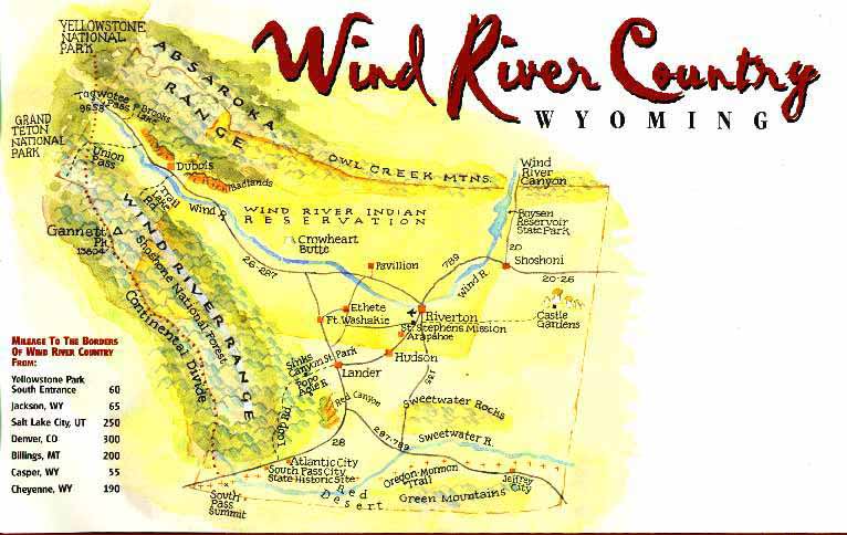
Area Descriptions
|
|||||||||||||||||||||||||||||||||||||||||||||||||
 |
|||||||||||||||||||||||||||||||||||||||||||||||||
|
(click map for full scale)
|
|||||||||||||||||||||||||||||||||||||||||||||||||
|
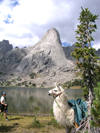
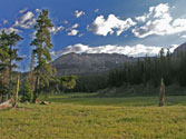
Wind River Range
|
|||||||||||||||||||||||||||||||||||||||||||||||||
.jpg) |
 |
.jpg) |
|||||||||||||||||||||||||||||||||||||||||||||||
|
One of the oldest ranges on earth, the
|
|||||||||||||||||||||||||||||||||||||||||||||||||
| Time frame July 1 through September 15 | |||||||||||||||||||||||||||||||||||||||||||||||||
|
|
|||||||||||||||||||||||||||||||||||||||||||||||||
| [Red Desert] [Absarokas] [Wind Rivers] [Sweetwater Canyon] [Sinks Canyon] [NOTES] [TOP] | |||||||||||||||||||||||||||||||||||||||||||||||||
|
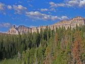
Absaroka Range
|
|||||||||||||||||||||||||||||||||||||||||||||||||
 |
 |
||||||||||||||||||||||||||||||||||||||||||||||||
|
In terms of geology, the
Time frame July 1 through September 15th |
|||||||||||||||||||||||||||||||||||||||||||||||||
|
|
|||||||||||||||||||||||||||||||||||||||||||||||||
| [Red Desert] [Absarokas] [Wind Rivers] [Sweetwater Canyon] [Sinks Canyon] [NOTES] [TOP] | |||||||||||||||||||||||||||||||||||||||||||||||||
|
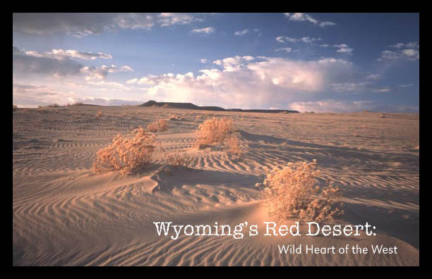
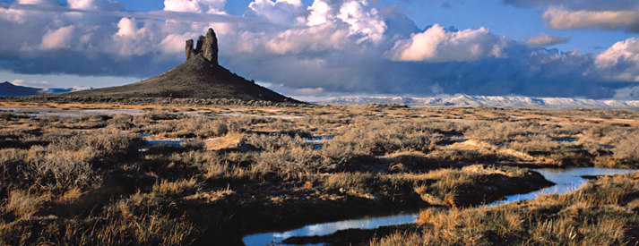
Red Desert
|
|||||||||||||||||||||||||||||||||||||||||||||||||
 |
|||||||||||||||||||||||||||||||||||||||||||||||||
 |
 |
||||||||||||||||||||||||||||||||||||||||||||||||
|
Located about 65 miles SW of Lander,
Time frame April 25 through mid-June |
|||||||||||||||||||||||||||||||||||||||||||||||||
|
|
|||||||||||||||||||||||||||||||||||||||||||||||||
| [Red Desert] [Absarokas] [Wind Rivers] [Sweetwater Canyon] [Sinks Canyon] [NOTES] [TOP] | |||||||||||||||||||||||||||||||||||||||||||||||||
|
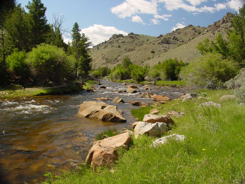
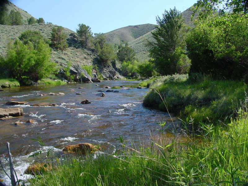
Sweetwater Canyon
|
|||||||||||||||||||||||||||||||||||||||||||||||||
 |
 |
||||||||||||||||||||||||||||||||||||||||||||||||
|
The beautiful canyon walls formed by the Sweet Water River which starts from the Wind River Range and runs south east and then east approximately 45 miles from Lander, just north of the Red Desert. The
Time frame May through September 15th. |
|||||||||||||||||||||||||||||||||||||||||||||||||
|
|
|||||||||||||||||||||||||||||||||||||||||||||||||
| [Red Desert] [Absarokas] [Wind Rivers] [Sweetwater Canyon] [Sinks Canyon] [NOTES] [TOP] | |||||||||||||||||||||||||||||||||||||||||||||||||
| Sinks Canyon | |||||||||||||||||||||||||||||||||||||||||||||||||
|
Is the mouth of the Popo Agie river at the edge of the Popo Agie Wilderness in the Shoshone National Forest. It is a spectacular steep canyon gouged by the Popo Agie River. It is home to deer and moose, and occasional black bear. The Sinks Canyon trips will include a visit past the "Popo Agie Falls". It is sub alpine terrain with sage brush, lodge pole pine, and aspens phasing into wide open meadow parks where the river meanders before plunging down the canyon. There is fishing for brook and rainbow. Elevations are 7,500 to 9,000 ft. Hiking is moderate, and trips are 3 or 4 days from a base camp. Time frame June 1 through September 15. July 1 through September 15 for fishing. |
|||||||||||||||||||||||||||||||||||||||||||||||||
|
|
|||||||||||||||||||||||||||||||||||||||||||||||||
| [Red Desert] [Absarokas] [Wind Rivers] [Sweetwater Canyon] [Sinks Canyon] [NOTES] [TOP] | |||||||||||||||||||||||||||||||||||||||||||||||||
|
Note: Most all of the above trips beginning and ending time frames are the historical times of access. In any given year, in any given location, the time frame can be pushed forward or backwards as it depends upon winter and spring snow levels. So if you have a trip in the beginning or end of the time frame, it is slightly possible we would need to move the geographic location of the trip due to weather. A 3 or 4 day trip, which would be 2 and 3 nights, would be going into one specific area and participating in day hikes and activities. We travel 5 to 6 miles, with the day hikes less. Day hike activities would include, exploring higher elevations and alpine meadows, fishing, wildlife viewing in early morning, wild flower identification, rock and mountain type identification. We usually pack a lunch, and return early to mid afternoon to base camp. If the trip has 6 or more people, there will be two guides, and day hike activities can be divided into groups if necessary. A 5 day trip or longer would be primarily progressive, meaning we have a further distance to travel or cover and move 6 to 10 miles per day with 1 or 2 layover days in the same spot with day hike activities. These trips are usually in the Wind River Range, but can take place in the Absaroka Range. These trips get into the heart of deep high alpine backcountry. |
|||||||||||||||||||||||||||||||||||||||||||||||||
|
Copyright © 2024 Lander Llama Company
|
|||||||||||||||||||||||||||||||||||||||||||||||||